Belarus city photo ecotour, greenways in European, temperate forests wild life, photo tours to wilde of Europa and Israel. Tips and tools for travelling in blog. Tourist places photos. Photos de villages. Photo and some image about nature.


Today Tabgha (also spelled Tabhka) is village, but a small area on the northwest shore of the Sea of Galilee, not far from Capernaum. There lies the Church of the Multiplication of Loaves and Fishes, the traditional site of the food multiplication story found in all four gospels (Matthew 14:13-21, Mark 6:31-44, Luke 9:10-17, John 6:5-15). It is also where Jesus appeared to his disciples after his resurrection (John 21:1-17).

The church is most famous for a mosaic of loaves and fishes from the original mid-third century church. The church was expanded in the fifth century, but soon after destroyed by the Persians when they invaded in 614. The Byzantine structures and mosaics were excavated in the 1930s by a German team. In 1982, the current reconstruction was added. The original mosaics depict water birds and plants, ecology of the marshy swamps typical of the area historically.

The name Tabgha is a variation on its ancient Greek name, Heptapegon, meaning “seven springs.” Six of these springs have been identified in modern times, including one known as “Job’s Spring.”

This was probably the shrine described by the pilgrim Egeria at the end of the 4th century:

“In the same place facing the Sea of Galilee is a well watered land in which lush grasses grow, with numerous trees and palms. Nearby are seven springs which provide abundant water. In this fruitful garden Jesus fed five thousand people with five loaves of bread and two fish.”

This pictures have been taken on 27 of September, 2011.
This photo gallery is as Israel Travel Photo Guide.

wikipedia.org


The Mount of Beatitudes (also traditionally known as the Mount Eremos) stands serenely near the northwest corner of the Sea of Galilee and Tabgha. It is the only definable mountain that is in close proximity to the Evangelical Triangle, that area in which Jesus conducted most of his ministry. The Triangle was the area falling between the cities of Capernaum, Chorazin and Bethsaida. The Mount of Beatitudes is the likely spot where Jesus sat down and gave the Beatitudes of Matthew 5:1-12.

Although there is discrepancy between Matthew’s version being on a hill and Luke’s being on a level place is easily reconciled with observation of many level places on the Galilean hillsides. Scripture gives no indication of the exact location of this event, but the Byzantines built a church to commemorate it at the bottom of the hill.

Today the mount is adorned with a lovely Roman Catholic church built in 1937 by the Franciscan Sisters with the support of the Italian ruler Mussolini. The building which was constructed by the noted architect Antonio Barluzzi is full of numerical symbolism. In front of the church, the symbols on the pavement represent Justice, Prudence, Fortitude, Charity, Faith and Temperance. Inside the church hangs the cloak from Pope Paul VI’s visit in 1964.

The church grounds have an abundance of beautiful flowers and a breathtaking view of the Sea of Galilee as well. Scattered throughout the grounds are plaques reminding the visitor of each Beatitude.

See photos of Mount of Beatitudes in this travel photo gallery from Verde Wanderer. This pictures have been taken on 27 of September, 2011.

wikipedia.org


Capernaum is an ancient fishing village on the north shore of the Sea of Galilee in Israel. It’s home to a celebrated Byzantine-era synagogue as well as the house where Jesus healed a paralytic and St. Peter’s mother-in-law.

Capernaum is frequently mentioned in the Gospels and was Jesus’ main base during his Galilean ministry. It is referred to as Jesus’ “own city” (Mt 9:1; Mk 2:1) and a place where he lived (Mt 1:13). He probably chose it simply because it was the home of his first converts, Peter and Andrew (Mk 1:21, 29).

They went to Capernaum, and when the Sabbath came, Jesus went into the synagogue and began to teach. The people were amazed at his teaching, because he taught them as one who had authority, not as the teachers of the law…

As soon as they left the synagogue, they went with James and John to the home of Simon and Andrew. Simon’s mother-in-law was in bed with a fever, and they told Jesus about her. So he went to her, took her hand and helped her up.” (Mark 1:21-22, 29-30)

Many familiar Gospel events occurred in this village. Capernaum is where Jesus first began to preach after the Temptation in the wilderness (Mt 1:12-17) and called Levi from his tax-collector’s booth (Mk 2:13-17). It was while teaching in the synagogue of Capernaum that he said, “Whoever eats my flesh and drinks my blood has eternal life, and I will raise him up at the last day.” (Jn 6:54)

Capernaum is where Jesus healed a centurion’s servant without even seeing him (Mt 8:5-13; Lk 7:1-10), Peter’s mother-in-law (Mt 8:14-15; Mk 1:29-30); the paralytic who was lowered thorugh the roof (Mk 2:1-12), and many others who were brought to him (Mt 8:16-17). And it was Capernaum that Jesus had set out from when he calmed a storm on the Sea of Galilee (Mt 8:23-27).

Jesus was harsh with his adopted home when it proved unrepentent despite his many miracles. “And you, Capernaum, will you be lifted up to the skies? No, you will go down to the depths. If the miracles that were performed in you had been performed in Sodom, it would have remained to this day. But I tell you that it will be more bearable for Sodom on the day of judgment than for you” (Mt 11:23-24).

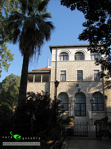
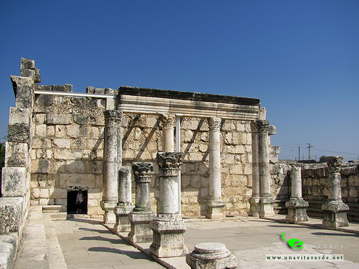
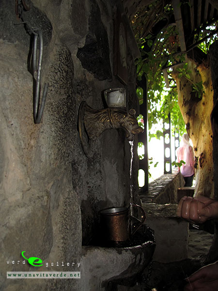
Capernaum was a Jewish village in the time of the Christ. It was apparently poor, since it was a Gentile centurion that built the community’s synagogue (Luke 7:5). The houses were humble and built of the local black basalt stone.

Christian presence is attested early in Capernaum and the village was predominantly Christian by the 4th century AD. Rabbinic texts from the 4th century imply considerable tension between the Jewish and Christian communities of the town.

Both the church and synagogue were destroyed prior to the Islamic conquest in 638. One possible scenario is that the Persian invasion of 614 gave the Jews the opportunity to act on their resentment of the now-powerful Christian community and demolish the church. In 629, the Byzantine emperor and his troops marched into Palestine, and under this protection the Christians may have destroyed the synagogue.

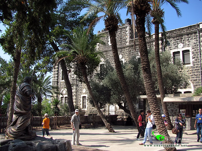
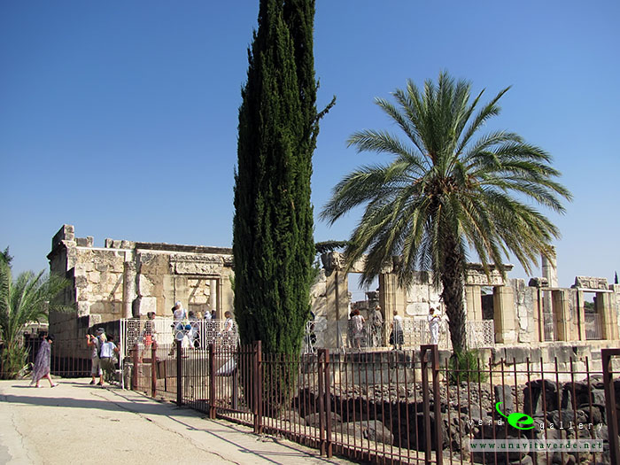
The synagogue of Capernaum is located just inland from the shore with its facade facing Jerusalem. It has been difficult to date, with scholarly opinion ranging from the 2nd to 5th centuries. It stands on an elevated position, was richly decorated and was built of imported white limestone, which would have contrasted dramatically with the local black basalt of the rest of the village. All of this would have given the building great beauty and status.

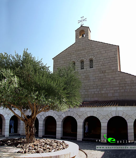
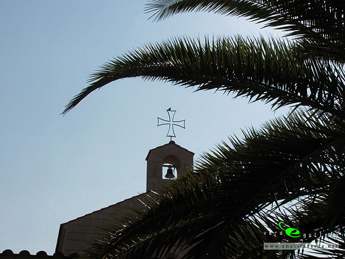
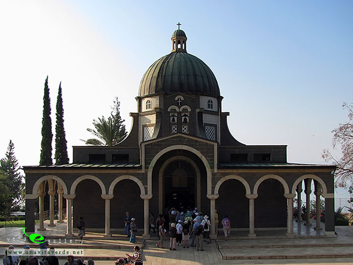
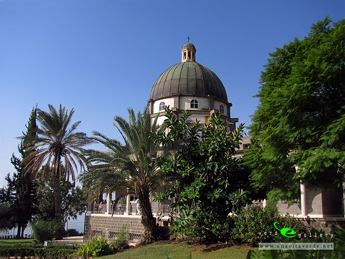
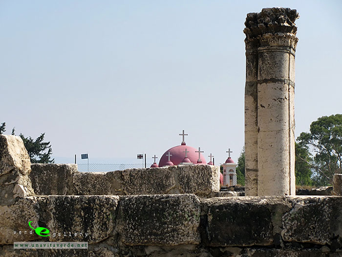
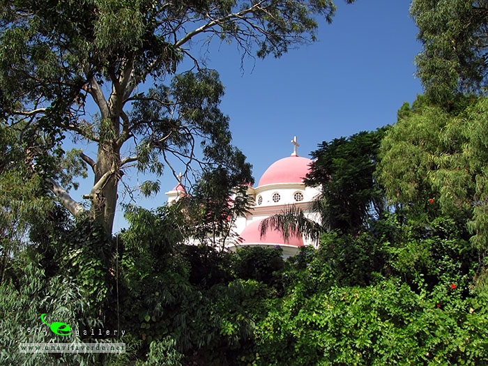
What to See? The ruined synagogue and the Greek Orthodox church stand quite close to each other near the shore, with ruins of 1st-to-6th-century houses in between. Also on the place are finely carved stones that belong to the synagogue, and a new Greek Orthodox church nearby.

Around the Greek Orthodox church the remains of the village have not yet been excavated, unlike the synagogue of Capernaum and the buildings around it.

This pictures have been taken on 27 of September, 2011.
This photo gallery is as Israel Travel Photo Guide.

wikipedia.org

Keukenhof, also known as the Garden of Europe, is the world’s largest flower garden. It is situated near Lisse, Netherlands. According to the official website for the Keukenhof Park, approximately 7,000,000 (seven million) flower bulbs are planted annually in the park, which covers an area of 32 hectares.

It is accessible by bus from the train stations of Haarlem, Leiden and Schiphol. It is located in an area called the “Dune and Bulb Region” (Duin- en Bollenstreek).

Keukenhof is open annually from mid-March to mid-May. The best time to view the tulips is around mid-April, depending on the weather.
OPENING HOURS: 8H00 – 19H30 (ticket office closes at 18H00).

wikipedia.org

Pictures taken in 16 of April, 2013.

Wiazynka (or Vyazynka) is a small village located not far from Minsk. Here, at folwark, in 1882 was born Ivan Lutsevich, better known as Janka Kupala the poet, playwright, publicist, Belarusian literature classics. His family was noble, although both of Kupala’s parents were employed as tenant farmers at the folwark. Kupala was thus essentially born into a landless peasant class. Kupala received a traditional Belarusian education, completing his studies in 1898. Following the death of his father in 1902, Kupala worked a variety of short-term jobs, including as a tutor, a shop assistant, and a record keeper.

Every year, during summer solstice, here celebrate Midsummer (Kupalle on BY).
This is a pagan summer celebration of fertility. Lately it was renamed into a Christian celebration of St John’s Day.  That fest usually involves youth going into a forests and the meadows, wearing flowers and grass garlands, dancing in roundelay around fires, jumping through fires.
A popular kind of Midsummer Night is fortune-telling – putting wreaths on water. People believed that on Midsummer Night the fern has a very special flower the fern flower (paparats-kvetka on BY) is glowing in the dark. The fern flower give a ability to see the future and find all the world’s hidden treasures. If you find the flower, you’ll be happy. But no one has found this yet. Search of the fern flower is one of the most mysterious rituals of Midsummer Night.

In 1972, the Government of Belarus has decided to establish the literary-memorial reserve writer.
Today the farm looks the same as in the XIX century and literary museum located there. Near the house the trees grow planted by the Kupala’s wife together with Belarusian writers and fans of the writer.
The reserve area is about 21 hectares. Nearby is the railway. Also near water channel connecting the Svisloch river and Vilija river. This is Vileika-Minsk water system, water system of Minsk. Where the water from the river Vilija (it’s Neman basin) being transferred to Svisloch river (Dnieper basin).  This is a unique engineering object of the Soviet period. Around the beautiful places, there is ecological trails for cyclists and backpackers.


A pictures and panorams photo of Wiazynka photo gallery added August, 15, 2015.